
Cities, 161 · 2025
Ripples create waves
How carefully placed, tenure-secure upgrades in Nantou Ancient Town spread vitality through the surrounding street network.
View published paper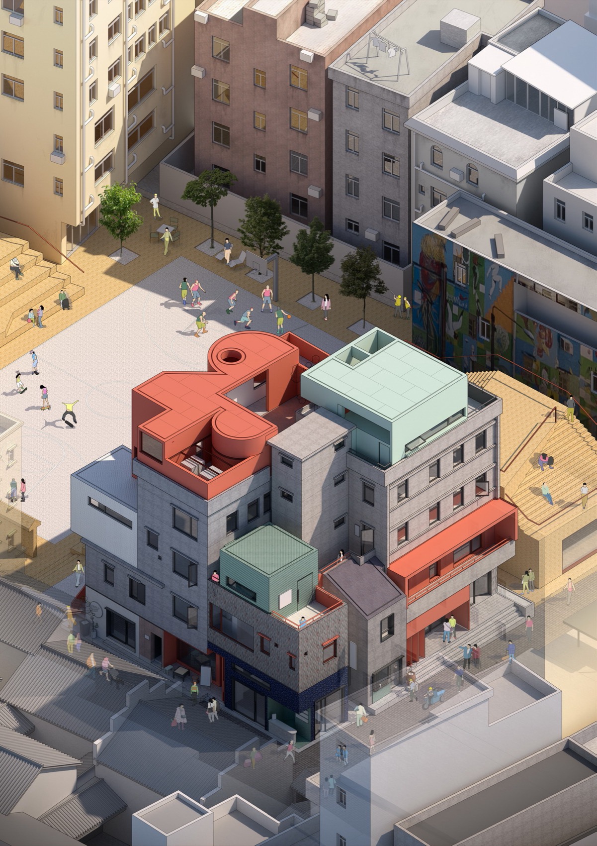
The story
Can a small intervention change a whole neighborhood?
Conventional urban renewal often treats change as a matter of scale: clear more land, build more floor area, and wait for value to follow. Nantou Ancient Town offers a different proposition. Between 2018 and 2024, a network of small projects renewed buildings, streets, cultural venues, and public spaces while preserving the settlement’s existing street grid and tenure structure.
The study asks whether those scattered “pinpricks” can do more than improve the sites they touch. By tracing commercial activity and movement across every street segment, it tests whether carefully placed attractors can create a catalytic effect—drawing people through the neighborhood and spreading economic vitality beyond each project boundary.
A living urban laboratory
Nantou changed by insertion, not erasure
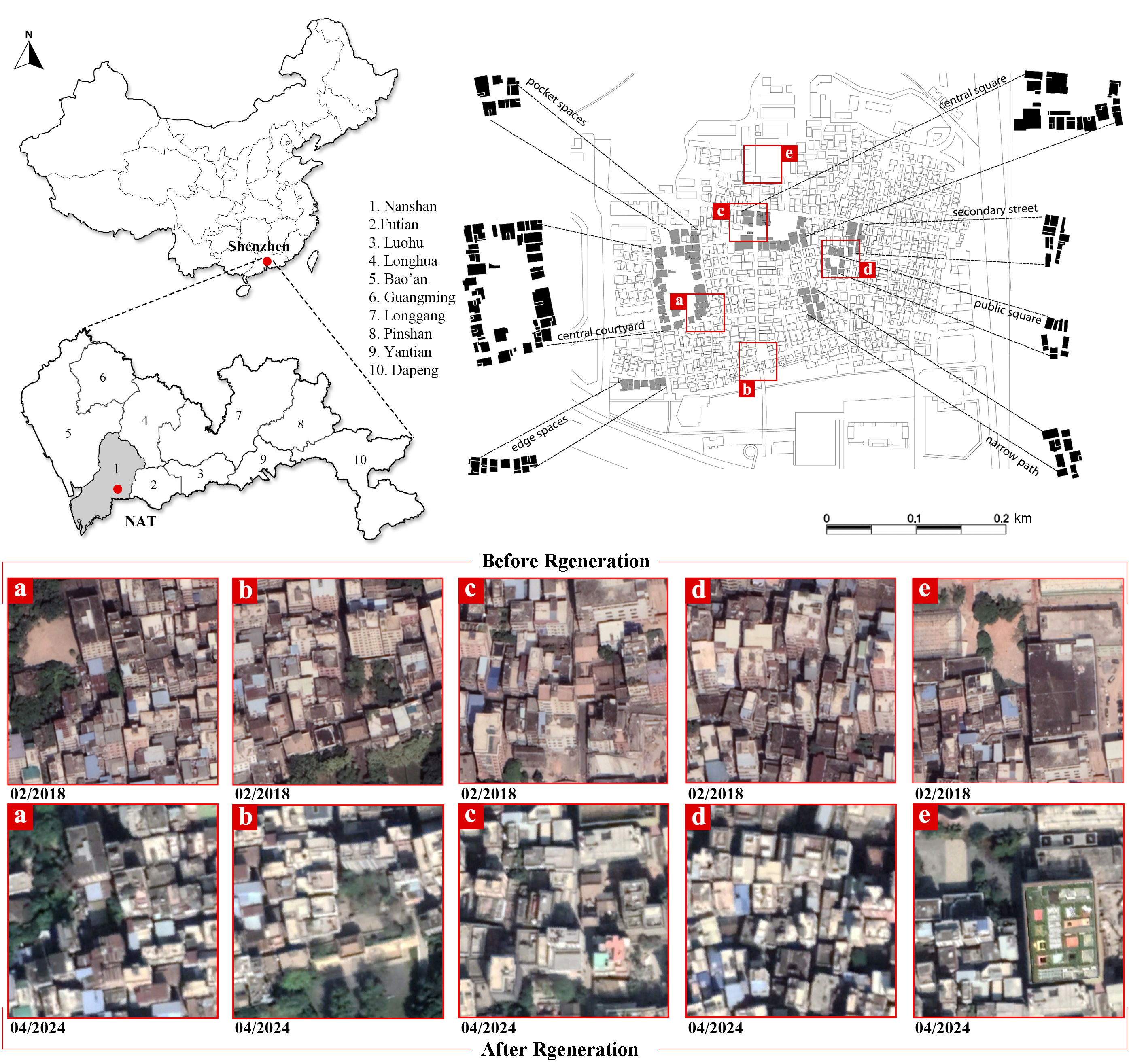
Nantou is a 0.38-square-kilometer urban village in central Shenzhen, home to more than 30,000 residents. Its dense blocks, narrow passages, pocket spaces, and mixed street life make it both an important low-cost neighborhood and a difficult setting for conventional redevelopment.
The regeneration program retained that underlying morphology. Satellite comparisons from 2018 and 2024 show targeted changes at courtyards, edge spaces, squares, and secondary lanes rather than a remade street network. This continuity makes Nantou a strong test of whether economic change can come from local attraction rather than wholesale physical restructuring.
Research design
Approach
- Before-and-after analysis of Nantou Ancient Town in Shenzhen.
- Difference-in-differences estimates of changes in commercial establishments.
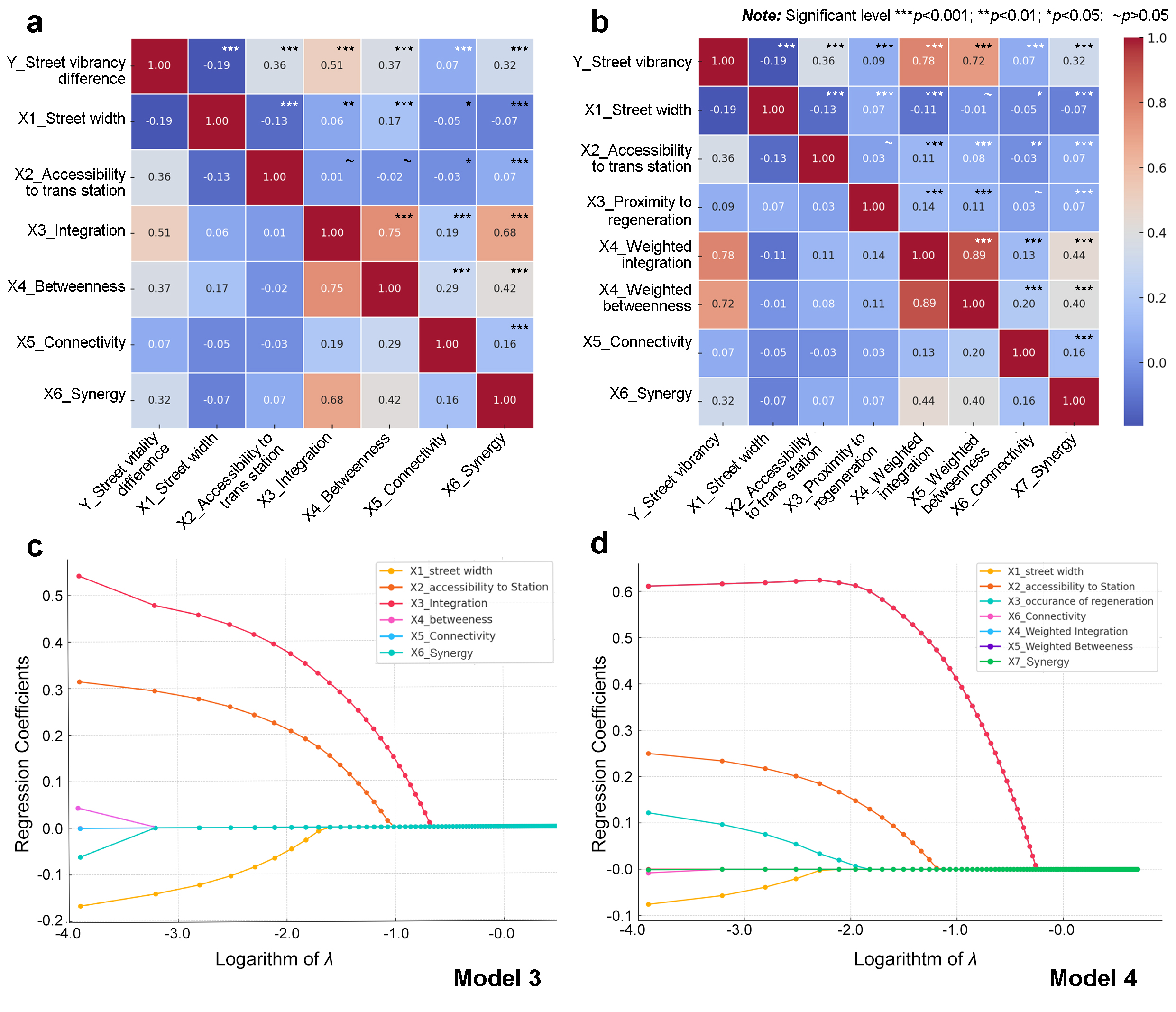
- Interpretable XGBoost, spatial configuration measures, and Lasso-based feature selection.
From projects to attractors
The projects were pinpricks; the street network carried the effect
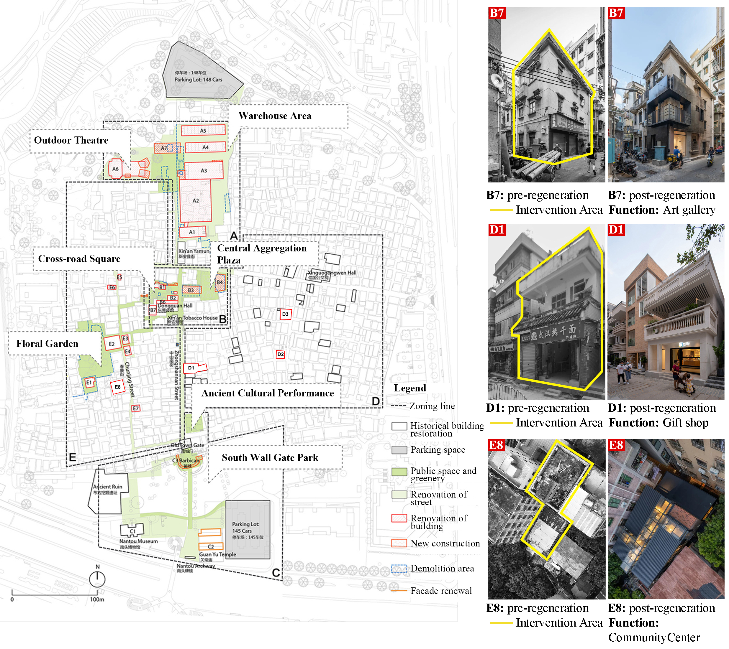
The intervention map reveals a constellation rather than a single redevelopment zone. Warehouses became cultural and commercial spaces, historic buildings took on new uses, and plazas, gardens, and renewed streets created destinations throughout the neighborhood.
Each destination acts as an external attractor—a reason to enter, turn, pause, and continue through the street network. The study measures that attraction alongside street width, transit access, and spatial configuration, allowing it to distinguish the inherited movement potential of the grid from the new pull created by regeneration.
What the evidence shows
Small projects, measurable waves
- Commercial vitality increased relative to the comparison neighborhood without wholesale reconstruction.
- Regeneration attractors add 0.31 to predictive performance, bringing the XGBoost model to an R² of 0.83.
- Angular integration is the strongest spatial channel linking local interventions to neighborhood-wide activity.
The neighborhood-wide result
Vitality spread beyond the intervention sites
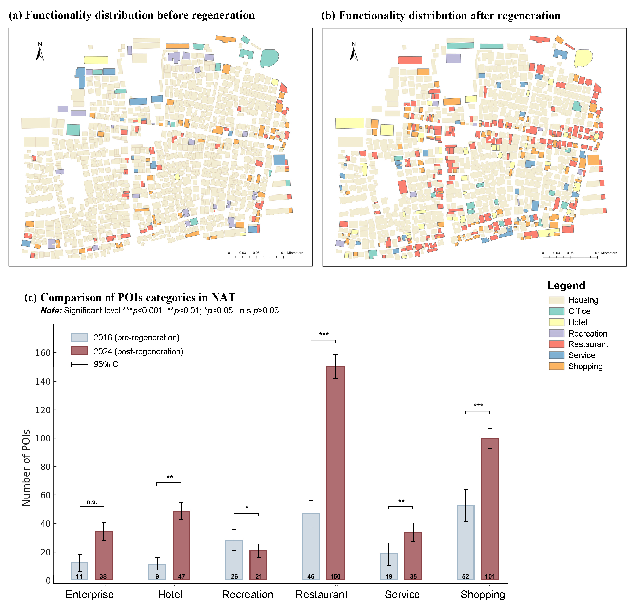
A difference-in-differences comparison shows that commercial establishments in Nantou increased more than in a similar untreated urban village. The program therefore changed the neighborhood economy even though it left the main street structure intact.
The functional map makes that shift visible. Restaurants, shops, services, and hotels became more numerous and more widely distributed after regeneration. Rather than concentrating benefits inside project parcels, the new destinations intensified activity along the routes that connect them.
Interpreting the ripple
The strongest model combines movement and magnetism
Spatial configuration alone explains much of where street life concentrates, but it underfits a neighborhood changed through small, scattered projects. When the model adds the attraction generated by regeneration, its predictive performance improves by 0.31 and reaches an R² of 0.83.
Angular integration—how closely a street segment connects to the wider network—emerges as the strongest spatial channel. The result is not that design replaces urban structure, but that strategic destinations and a connected street system reinforce one another. The ripple is strongest where a new reason to visit meets a route capable of carrying movement onward.
The policy lesson
Design the ripple, not just the site
Micro-regeneration should be planned as a connected portfolio of attractors, not a collection of isolated beautification projects. Cultural venues, public facilities, pocket parks, and active ground floors have wider effects when their locations reinforce walkable routes and the movement potential already embedded in the street network.
That approach reframes “good growth.” Success is not limited to property-price uplift or the footprint of construction; it includes stronger local businesses, living-wage activity, and renewed public life without displacement. For planners, the practical task is to identify where a small intervention can enter the network and travel farthest.